

Himalayan Glacier Collapse: Nepal Flood Lessons for India
The suspected Himalayan glacier collapse behind Nepal’s devastating flash flood has highlighted the growing vulnerability of the Himalayan region. The incident is especially important for India, where similar glacier-related disasters have occurred in recent years.
Exam Relevance: UPSC Prelims GS-I | UPSC Mains GS-I & GS-III | HPAS Prelims GS-I | HPAS Mains GS-I — Geography, Environment & Disaster Management.
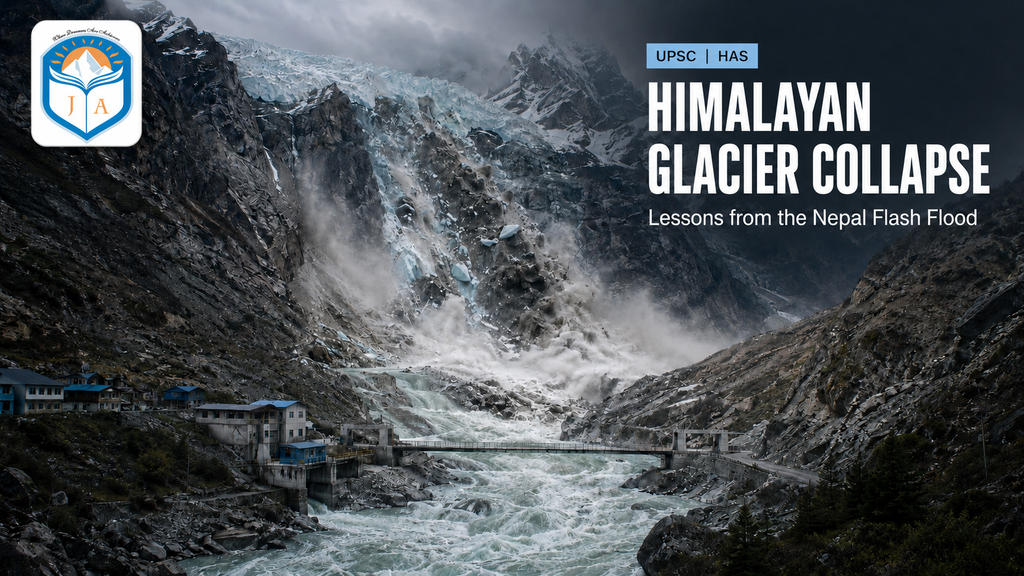
For India, the event carries particular significance because the Himalayan states have experienced similar disasters in Kedarnath in 2013, Chamoli in 2021, Sikkim in 2023 and Dharali in Uttarakhand in 2025. The National Disaster Management Authority (NDMA) has therefore proposed a detailed study of the Nepal event to strengthen India’s preparedness against such cascading hazards.
What Is a Glacier?
A glacier is a large, persistent mass of ice formed through the accumulation and compaction of snow over several years. It moves slowly under the influence of gravity and plays an important role in feeding Himalayan rivers.
A hanging glacier develops on a steep mountain slope or high-altitude valley and appears to “hang” above the main valley. Its steep location makes it vulnerable to sudden detachment.
What Is a Glacial Collapse?
A glacial collapse refers to the sudden detachment of a large volume of glacier ice from its bed or mountain slope. The collapsing mass may contain millions of cubic metres of ice, snow, rocks and water.
As this material moves rapidly downslope, it may transform into an ice-rock avalanche or a highly destructive debris flow. When it enters a narrow river valley, it can displace water, temporarily block the river and produce a powerful flood wave.
Although “glacial collapse” is not a formally standardised glaciological term, it is widely used to describe such sudden glacier-mass failures.
Glacier Collapse and GLOF: Understanding the Difference
A glacier collapse should not be confused with a Glacial Lake Outburst Flood, although both can produce similar downstream destruction.
A Glacial Lake Outburst Flood (GLOF) occurs when water stored in a glacial lake is suddenly released because its natural dam—usually made of moraine, ice or loose debris—fails.
Such a breach may be triggered by:
- An avalanche or landslide entering the lake
- Excessive snow and glacier melting
- Heavy rainfall
- Earthquakes
- Failure of an unstable moraine dam
- Ice or rock falling from a hanging glacier
Thus, a glacier collapse may itself generate a flood or trigger a GLOF by falling into a glacial lake.
What Happened in Nepal?
The recent Nepal disaster affected the Bhote Koshi–Trishuli river system near the Nepal–Tibet border. Satellite images indicated the detachment of a large mass of ice, snow and rocks from a hanging glacier.
The falling mass reportedly descended from a considerable height and entered the river valley with tremendous energy. The resulting ice-rock avalanche and debris flow caused the river channel to swell rapidly, devastating settlements, roads, bridges and hydropower infrastructure downstream.
However, scientists are still examining the precise sequence of events. It is important to distinguish between the immediate trigger—such as glacier collapse—and contributing conditions such as unusually high temperatures, rapid snowmelt, slope instability or extreme rainfall.
Did Climate Change Cause the Disaster?
No single glacier-related disaster can automatically be attributed entirely to climate change without a detailed scientific attribution study. Glacier collapses may also be influenced by local topography, geological instability, earthquakes, snowfall patterns and short-term temperature changes.
Nevertheless, global warming acts as an important risk multiplier. Rising temperatures accelerate glacier retreat, increase meltwater within and beneath glaciers, weaken ice-rock connections and contribute to the formation and expansion of glacial lakes.
Therefore, climate change may not always be the immediate trigger, but it is increasing the background conditions in which Himalayan hazards become more frequent and destructive.
Why Are the Himalayas Particularly Vulnerable?
The Himalayas are geologically young, tectonically active and characterised by steep slopes, fragile rocks and narrow river valleys. Climate change, unplanned construction and increasing human presence have added to this natural vulnerability.
Major risk factors include:
- Rapid retreat and thinning of glaciers
- Expansion of moraine-dammed glacial lakes
- Unstable hanging glaciers and mountain slopes
- Earthquakes, landslides and extreme rainfall
- Hydropower projects and settlements in narrow valleys
- Road cutting, deforestation and poorly planned construction
- Limited monitoring equipment in remote high-altitude regions
The risk is especially relevant to Himachal Pradesh, Uttarakhand, Sikkim, Arunachal Pradesh, Ladakh and Jammu and Kashmir.
India’s Preparedness
India has expanded its preparedness from limited glacial-lake mapping to large-scale satellite monitoring, risk assessment and early-warning development. However, complete ground-level coverage of all vulnerable Himalayan locations is still a work in progress.
National GLOF Risk Management Programme
The government has approved the National GLOF Risk Management Programme (NGRMP) with an outlay of ₹150 crore for Arunachal Pradesh, Himachal Pradesh, Sikkim and Uttarakhand. The Central Government’s share from the National Disaster Mitigation Fund is ₹135 crore.
According to a Ministry of Home Affairs update dated 22 July 2025, ₹27.73 crore had been released under the programme. Its components include hazard assessment, monitoring, early-warning systems, structural mitigation and community-level capacity building.
Expansion of Glacial-Lake Monitoring
Until 2024, the Central Water Commission monitored 902 glacial lakes and water bodies larger than 10 hectares during the monsoon period. From 2025, this coverage was expanded to 2,843 glacial lakes and water bodies, comprising 2,485 glacial lakes and 358 water bodies.
Of these, 681 glacial lakes are located within India—179 in Ladakh, 76 in Jammu and Kashmir, 17 in Himachal Pradesh, 13 in Uttarakhand, 72 in Sikkim and 324 in Arunachal Pradesh. These are monitored through remote-sensing technology, particularly between June and October.
Use of Space Technology
By December 2025, ISRO had mapped Himalayan glacial lakes larger than 0.25 hectares and completed GLOF risk modelling for 15 prioritised lakes. In August 2026, the government again identified GLOF monitoring and Early Warning Systems as important applications of space technology. Glacial-lake inventories and hazard-risk maps have also been prepared for Jammu and Kashmir.
Warning Dissemination and Response
India’s SACHET platform integrates alerts from agencies such as the CWC, IMD, GSI, INCOIS and State Disaster Management Authorities. It enables geo-targeted warnings through regional-language SMS, mobile applications, browser alerts and satellite-based communication.
However, satellite monitoring alone cannot constitute a complete GLOF warning system. High-risk valleys also require ground sensors, water-level gauges, automatic weather stations, sirens, evacuation routes and trained local response teams.
Developments Following the Nepal Disaster
In August 2026, the NDMA announced that it would undertake a comprehensive study of the Nepal glacier-collapse event. The study is expected to examine the chain involving glacier detachment, ice-rock avalanche, river blockage, debris flow and flash flooding.
The incident has reinforced the need to extend Indian preparedness beyond glacial lakes to include unstable hanging glaciers, landslide-prone slopes and vulnerable hydropower infrastructure.
What More Needs to Be Done?
India must move from a primarily response-oriented system towards anticipatory disaster-risk management.
Important measures include:
- Continuous monitoring: High-risk glaciers, lakes and mountain slopes should be monitored through satellites, drones, seismic sensors, automatic weather stations and water-level gauges.
- Multi-hazard early warnings: Warning systems must cover GLOFs, glacier collapses, landslides, flash floods and temporary river-blocking events because these hazards often occur in combination.
- Last-mile communication: Alerts must reach downstream villages, tourists, military posts, road users and hydropower workers through sirens, mobile messages, radio networks and local volunteers.
- Risk-sensitive development: Hydropower projects, roads, hotels and settlements should undergo glacier- and landslide-risk assessments before approval.
- Evacuation preparedness: Vulnerable villages need marked evacuation routes, safe shelters, mock drills and trained local response teams.
- Regional cooperation: Himalayan rivers and glaciers cross national boundaries. India, Nepal, Bhutan and China must strengthen real-time sharing of meteorological, hydrological and glacier-monitoring data.